Commercial Drone Operations Support
- Commercial Flight Permit (ROC)
- Drone Import Permit
- Import on behalf
Since Serian's inception in 2020, we've innovated our way to a new benchmark for excellence in our industry. We embed alongside your team across the full project lifecycle - consult, comply, train, deploy, capture, analyse and support - so you get compliant, audit-ready geospatial outputs without the hand-off gaps that derail typical engagements.
Expand your offering with KCAA permit support, drone rental, flight-planning and data processing software
From large-scale water infrastructure to county masterplans, our geospatial work powers decisions in industries where accuracy is non-negotiable.
See how our survey and drone mapping workflows translate complex field programmes into reliable design-ready geospatial outputs.
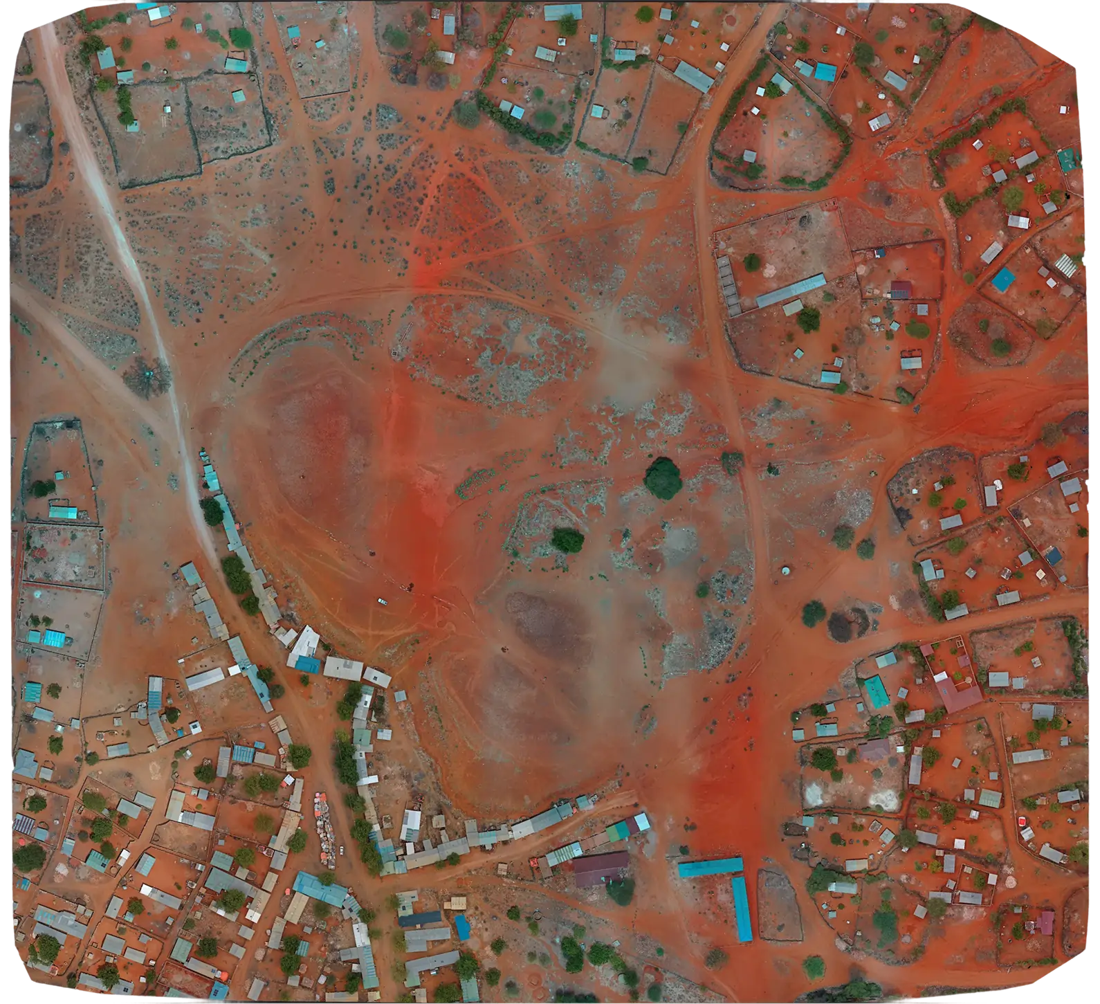
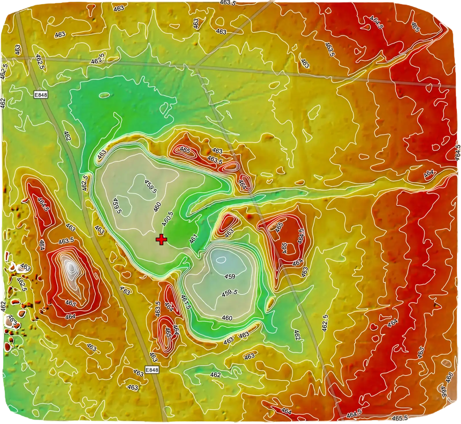
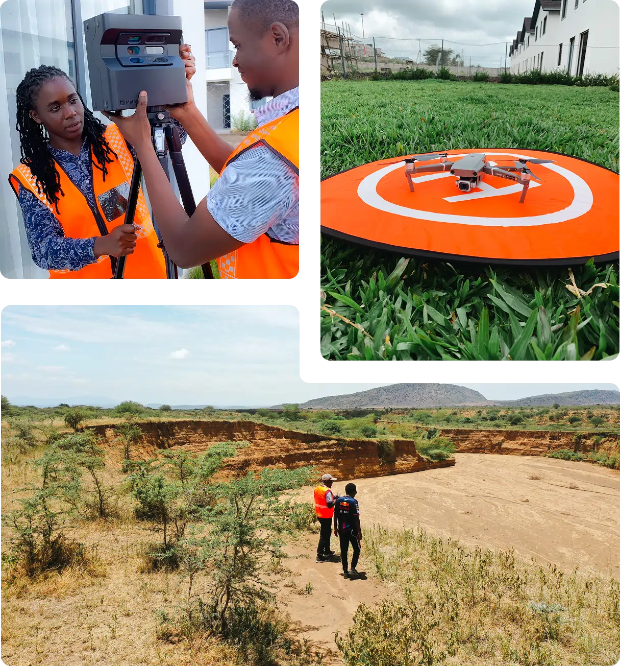
Serian conducted topographical surveys across 60 sites of approximately 80 acres each, spanning five northern Kenya counties, to support suitability assessment and MAR infrastructure design.
Expand your offering with KCAA permit support, drone rental, flight-planning and data processing software
Our in-house team ensures flawless execution from data capture to insights, eliminating handoff errors and maximizing quality.
Our in-house team ensures flawless execution from data capture to insights, eliminating handoff errors and maximizing quality.
Our in-house team ensures flawless execution from data capture to insights, eliminating handoff errors and maximizing quality.
Trusted by organisations across real estate, agriculture, education and infrastructure to deliver reliable geospatial outcomes.


Real-world geospatial work delivered for clients across water, infrastructure, agriculture and education sectors.
Topographical Survey & Control Point Establishment for a 201 km Pipeline Corridor in Lodwar, Turkana County
Captured high-precision topographic data and established geodetic control along a 201 km corridor to support detailed pipeline network design for water infrastructure in Lodwar.
View Project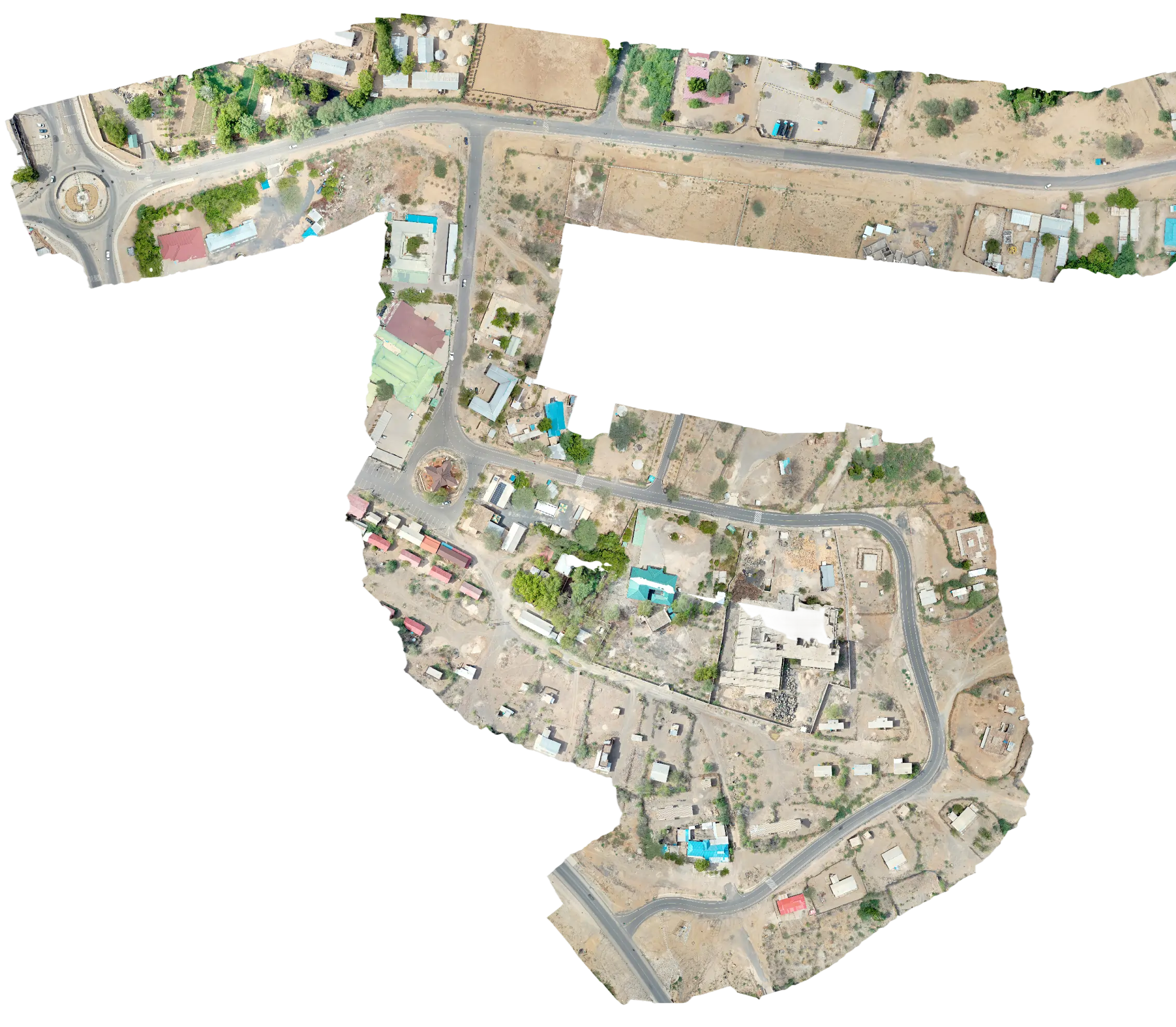
Lakeview Heralds Academy Enhances Campus Planning with Drone Mapping
We utilized a DJI Mavic 2 Pro drone to capture high-resolution aerial imagery to produce an accurate orthophoto and DEM of the entire school grounds.
View Project
Duka Moja Ranch Ltd Unlocks Land Potential with Precision Drone Topographical Survey
We deployed a Mavic 2 Pro drone equipped with a high-resolution 4K camera and RTK GNSS equipment to capture detailed aerial data.
View Project
We hold the regulatory approvals and supplier partnerships required to deliver compliant, audit-ready geospatial outcomes across East Africa.

