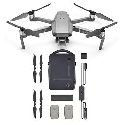
Rental Mavic 2 Pro
Hire the DJI Mini 4 Pro: A sub 250g 4K camera drone ideal for beginners, aerial content creation, and some commercial jobs. This rental combo includes three flight batteries, smart controller, and charging.
Serian Geospatial offers flexible drone and payload rentals, providing cost-effective access to cutting-edge aerial technology. We ensure KCAA compliance and seamless integration, empowering your business to effectively harness aerial intelligence without significant capital investment.
Need a drone for your project without the upfront cost? Serian Geospatial provides drone rentals, giving you cost-effective access to cutting-edge aerial technology. We'll help you get the right drone for your needs, ensuring seamless integration and compliance for your operations.
Hire the DJI Mini 4 Pro: A sub 250g 4K camera drone ideal for beginners, aerial content creation, and some commercial jobs. This rental combo includes three flight batteries, smart controller, and charging.
Need specialized tools for your drone operations? Serian Geospatial offers payload and accessories rentals, providing cost-effective access to cutting-edge technology. Choose from smart controllers, advanced survey payloads, and essential survey equipment to get the right tools for your specific data acquisition needs, ensuring seamless integration and compliance for your projects.
No items available at the moment. Check back soon!
Need specialized tools for your drone operations? Serian Geospatial offers payload and accessories rentals, providing cost-effective access to cutting-edge technology. Choose from smart controllers, advanced survey payloads, and essential survey equipment to get the right tools for your specific data acquisition needs, ensuring seamless integration and compliance for your projects.
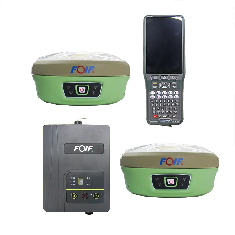
Hire the FOIF A90 GNSS receiver — a high-accuracy multi-constellation base and rover kit ideal for cadastral surveys, topographical mapping, and engineering setting-out. This rental package includes the base unit, rover pole, controller, and all necessary accessories.
Explore more of what Serian Geospatial offers across drone, mapping and geospatial services.