Survey plans and cadastral maps
Boundary survey plans prepared to the standards required for land registry filing, title processing or court submission.
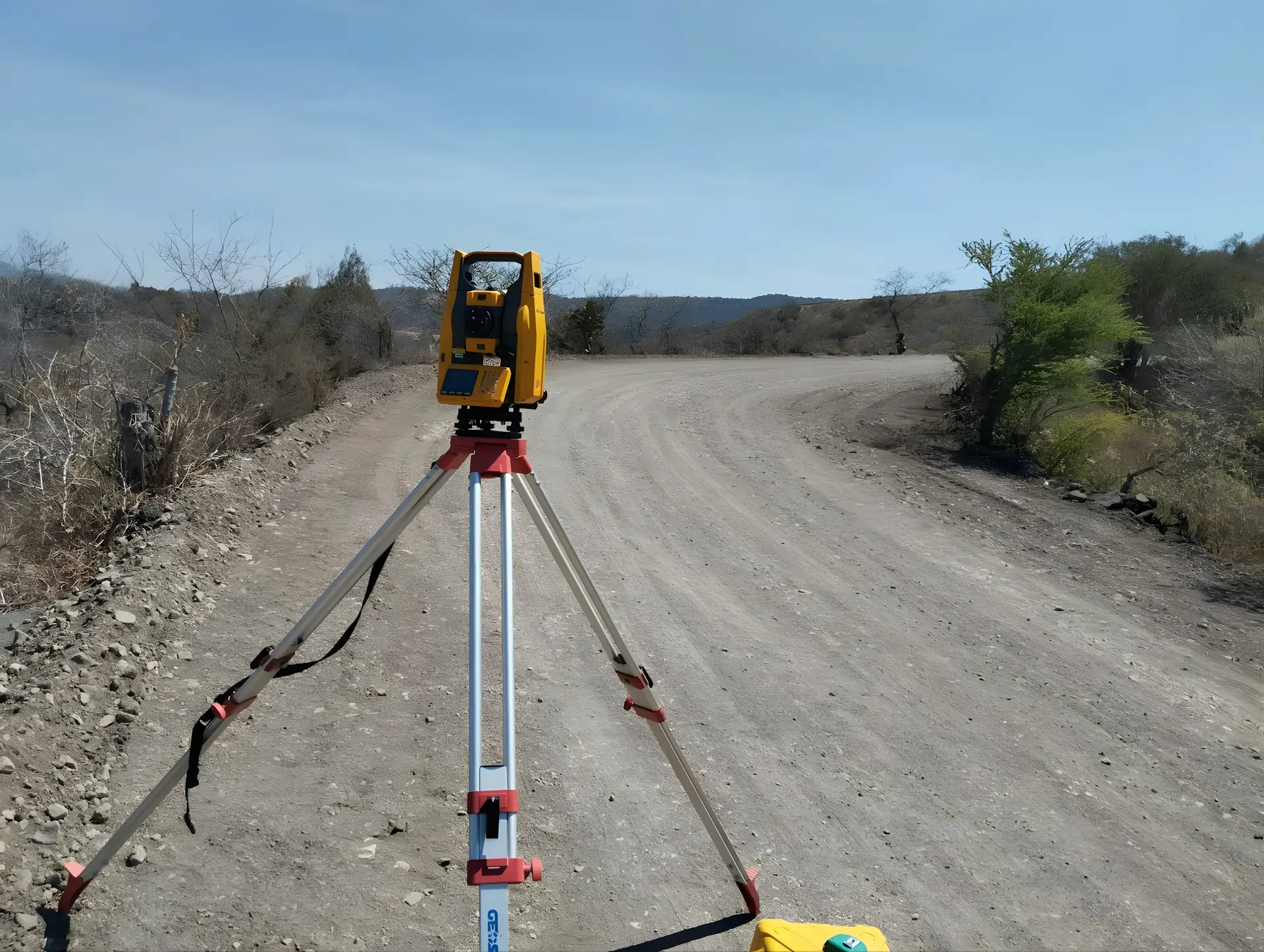
Legally defensible boundary demarcation, subdivision layouts and cadastral plans — using RTK/GNSS, total station and drone verification across Kenya.
Land disputes, subdivision approvals, title processing and development planning all start with the same question: where exactly is the boundary? We establish, re-establish and verify property boundaries using RTK/GNSS rovers, total stations and, where useful, drone imagery to provide the spatial context around the parcel.
You get a survey plan that holds up at the land registry, in a boardroom, or in court — with the control documentation, beacon coordinates and cadastral references behind it. We work with private landowners, developers, county governments and legal teams across Kenya.
Everything the land registry, your lawyer or your development consultant needs — in one pack.
Boundary survey plans prepared to the standards required for land registry filing, title processing or court submission.
Precise coordinates for every boundary beacon, referenced to the national geodetic framework and your project CRS.
Parcel layouts for subdivision or amalgamation applications, with areas, frontages and access points dimensioned.
Where useful, an orthomosaic or annotated aerial image that gives the visual context around the parcel — fences, structures, access, neighbours.
Whether it's a single plot or a 200-parcel estate, the discipline underneath is the same.
We pull the existing registry records, deed plans and any prior survey data before going to site.
RTK/GNSS and total station work to fix, re-establish or verify boundary points. Beacons are placed or checked.
Survey plans, coordinates and supporting documents are prepared to registry standards.
Plans are handed over with the documentation needed for title processing, subdivision approval or legal proceedings.
Almost every land transaction, dispute or development starts here.
Buying, selling, transferring or mortgaging land — the registry needs a current survey plan.
Breaking a parcel into plots for sale or development, with layouts that meet county planning requirements.
Independent, documented boundary evidence for mediation, court or county dispute resolution.
A boundary survey is only as good as the control behind it and the documentation around it. We deliver both — so the plan doesn't come back for questions.
Quick answers to the things landowners, lawyers and developers usually ask.
A boundary survey establishes or verifies the legal limits of a parcel — beacon positions, boundary lines, areas — for registry, title or legal purposes. A topographical survey maps the physical features and terrain within and around a site for design and engineering. Many projects need both; we often run them together.
Yes. We establish concrete or iron-pin beacons at boundary corners as required. Existing beacons are checked and referenced. If beacons are missing or disturbed, we re-establish them from the control network and registry records.
Yes. We prepare the subdivision layout, parcel schedules, survey plans and the supporting documentation needed for county planning and land registry approval.
A single urban plot is typically completed in one to two days of fieldwork, with plans delivered within a week. Multi-parcel subdivisions and estates take longer depending on parcel count, access and registry records. We scope the timeline before starting.
Other things our team gets brought in for, often on the same projects.
We hold the regulatory approvals and supplier partnerships required to deliver compliant, audit-ready geospatial outcomes across East Africa.

