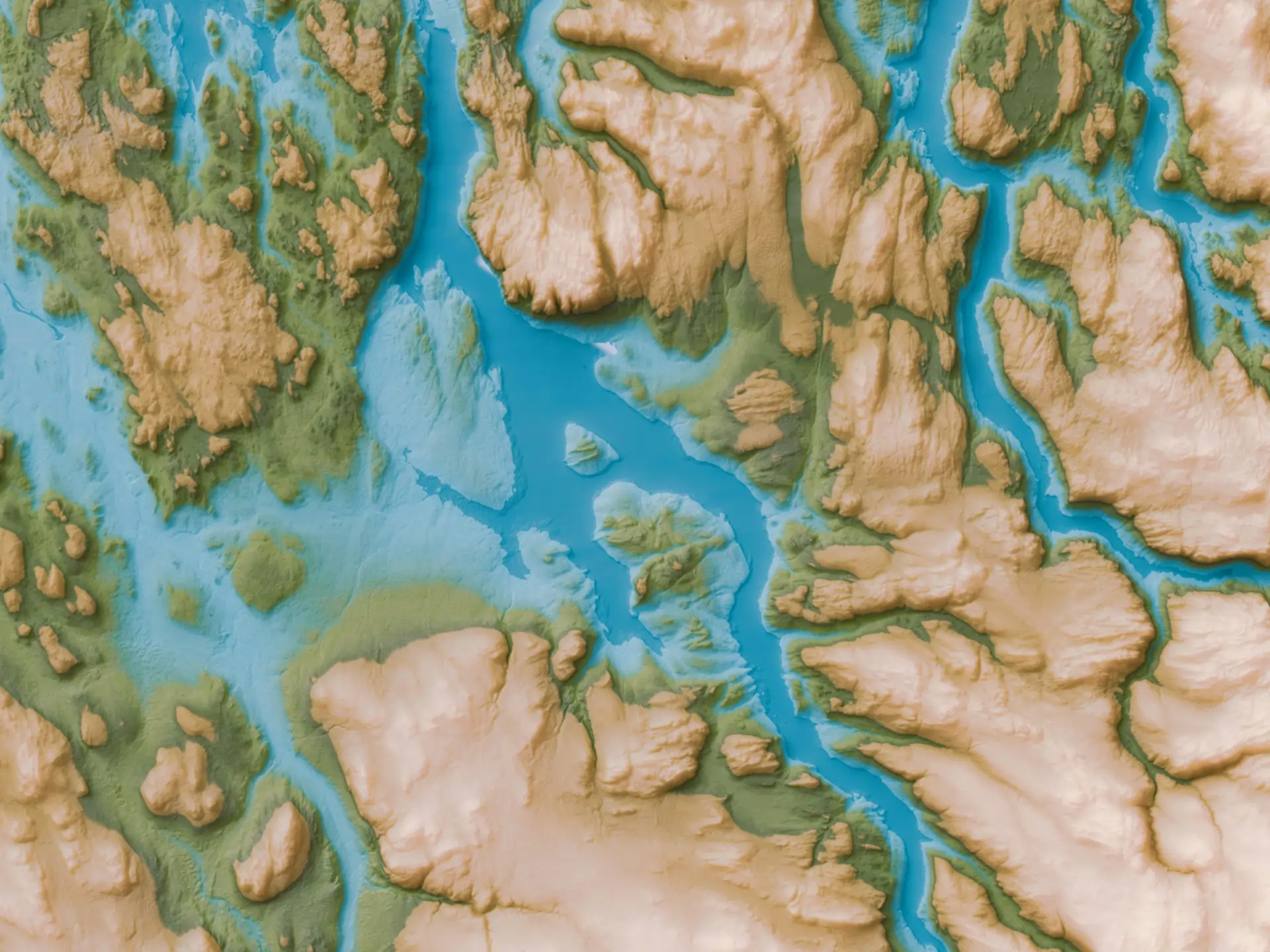
Catchment delineation
Watershed, sub-catchment and drainage network maps based on high-resolution DTMs.
Catchment, flood and stormwater modelling that gives engineers and planners the numbers they need for design and approval.
Water is the variable that breaks projects after they're built. Bridges, roads, dams, drainage schemes and developments all need somebody to answer where surface water flows from, how much, and what happens in a 1-in-50-year storm.
We combine high-resolution terrain data, rainfall records and hydrological models to map drainage networks, simulate flood extents, size stormwater infrastructure and inform water-sensitive design. The output is the quantitative basis engineers need for design and approving authorities expect for sign-off.
Each model is shaped around the design or approval decision it has to support.
Watershed, sub-catchment and drainage network maps based on high-resolution DTMs.
Modelled flood extent and depth for design return periods such as 1:10, 1:50 or 1:100 years.
Runoff calculations and sizing inputs for culverts, drains, retention basins and outfalls.
Methodology, assumptions and results documented for engineers, regulators and project owners.
Models are only as good as the terrain and the rainfall going in. We obsess over both.
We define the area of interest, drainage pattern and what the model has to answer.
Terrain data, soil data, land cover and rainfall records are pulled together and quality-checked.
Hydrological and hydraulic models are built, calibrated where data allows, and run for the design scenarios.
Results, maps and design inputs are packaged for the engineering or approval workflow.
Anywhere water has to be designed for, defended against or accounted for.
Sizing culverts, bridges and stormwater systems for design storms.
Flood extent mapping for development sites, EIA studies and insurance.
Catchment yield, reservoir studies, irrigation scheme planning and water supply.
Hydrological models get scrutinised by reviewers, lenders and regulators. We document the methodology and the assumptions so the numbers stand on their own.
Other things our team gets brought in for, often on the same projects.
We hold the regulatory approvals and supplier partnerships required to deliver compliant, audit-ready geospatial outcomes across East Africa.

