Control networks and benchmarks
Primary and secondary control points established, coordinated, documented and protected — the reference frame for everything that follows.
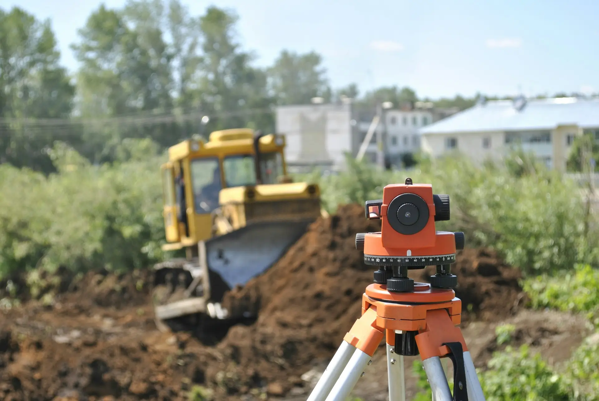
Control networks, setting out, levelling and as-built surveys for construction, roads, pipelines and infrastructure projects across Kenya.
Between the CAD drawing and the finished structure there's a survey crew translating coordinates into paint marks, pegs and profile boards. We provide the control networks, setting-out services, levelling runs and as-built checks that keep construction on line and on level.
The work covers buildings, roads, pipelines, bridges, drainage and utility corridors. We use RTK/GNSS rovers, total stations and digital levels — matched to the precision the structure demands. Every setting-out point is traceable back to a documented control network.
Sized for a single building pad or a multi-kilometre corridor — the documentation standard doesn't change.
Primary and secondary control points established, coordinated, documented and protected — the reference frame for everything that follows.
Building corners, column grids, road centrelines, pipeline alignments, kerb lines and formation levels transferred from the design to the ground.
Precise levelling runs for formation checks, floor levels, drainage falls and structural monitoring.
Post-construction verification comparing what was built to what was designed — positions, levels and dimensions documented for handover.
Control first. Everything else hangs off it.
Primary control points are established and connected to the project datum. Benchmarks are set for levelling.
We take the engineer's coordinates and transfer them to the ground — pegs, marks, profiles — with checks built in.
Ongoing setting out, level checks, re-establishment of disturbed marks and periodic as-built captures as construction progresses.
Final as-built survey comparing the completed structure to the design, with a report documenting deviations.
Any construction project that needs to be in the right place at the right level.
Column grids, foundation setting out, floor levels and vertical alignment for residential, commercial and industrial buildings.
Centreline, offset, formation and drainage setting out for road construction and rehabilitation.
Alignment, invert levels and trench profiles for water, sewer, electrical and telecoms infrastructure.
Setting-out errors are expensive to fix after concrete is poured. We document the control, check the marks and hand over the as-built — so the numbers are there when the engineer asks for them.
Common questions from project managers, engineers and contractors.
Yes. We work from DWG, DXF or coordinate schedules provided by your design team. We check the geometry, confirm the project datum and CRS, and transfer the design to the ground. Any discrepancies between the drawing and the existing site are flagged before setting out begins.
Yes. We capture final positions and levels of completed structures, compare them to the design and deliver an as-built report with deviations documented. This is used for handover, quality assurance and contract closeout.
We establish a primary control network connected to the national geodetic framework, then densify with secondary points as the site demands. Control is documented, coordinated and protected. Re-observation and adjustment are scheduled if the project runs long enough for ground movement to matter.
Yes. We offer per-visit, weekly or retainer arrangements depending on the project's setting-out and checking requirements. The survey crew integrates with your site team's programme.
Other things our team gets brought in for, often on the same projects.
We hold the regulatory approvals and supplier partnerships required to deliver compliant, audit-ready geospatial outcomes across East Africa.

