Textured 3D meshes
Photoreal models of terrain, buildings or assets. OBJ, FBX, GLB — your call.
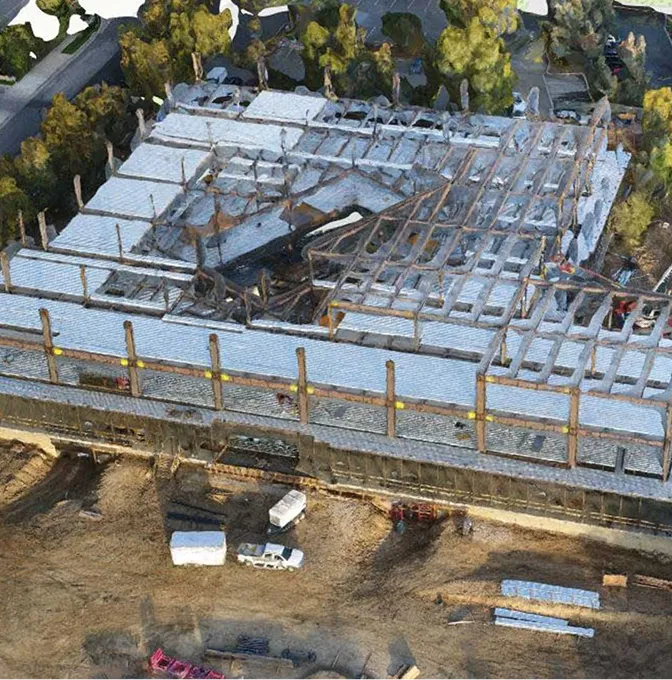
Photoreal site models, point clouds and digital twins built from drone imagery and ground capture.
A 2D map tells you where things are. A good 3D model tells you what it's like to stand there. We turn drone imagery, ground photos and survey points into models that make sites legible to people who can't visit them.
Sometimes that's a presentation. Sometimes it's a measured base for design. Sometimes it's a digital twin that needs to update every quarter. We scope each project around the level of detail and accuracy that question deserves.
What you receive depends on whether the priority is looking, measuring or interacting.
Photoreal models of terrain, buildings or assets. OBJ, FBX, GLB — your call.
Measured spatial datasets when geometry, dimensions and inspection are the point.
3D basemaps that show terrain, surroundings, levels and constraints in one view.
Web-ready models or hosted viewers so a team in another city can pan, zoom and annotate without specialist software.
A clean 3D model starts with capture planning that anticipates occlusion, edge detail and how the model will actually be used.
Realism, accuracy, coverage, format. Whether it's for a design review or an investor pitch.
Drone passes from planned angles and heights to cover faces, edges and surfaces — plus terrestrial fill where it matters.
Imagery and control are processed into meshes and clouds, then cleaned of the floaters and ghosts a raw build produces.
Models packaged for GIS, CAD, web review or stakeholder presentation — whichever the project actually needs.
When 2D drawings and a site visit aren't going to cut it.
A realistic base for design teams to test ideas against.
Properties, campuses and facilities walked through by remote stakeholders.
A revisitable record of an asset, structure or site after the field team has left.
We obsess over the geometry as much as the texture. Models look right in a presentation and behave correctly in CAD.
Other things our team gets brought in for, often on the same projects.
We hold the regulatory approvals and supplier partnerships required to deliver compliant, audit-ready geospatial outcomes across East Africa.

