High-resolution roof imagery
Detailed overhead and oblique photographs of the entire roof surface — every ridge, valley, flashing, gutter and penetration documented at resolution that shows individual fixings.
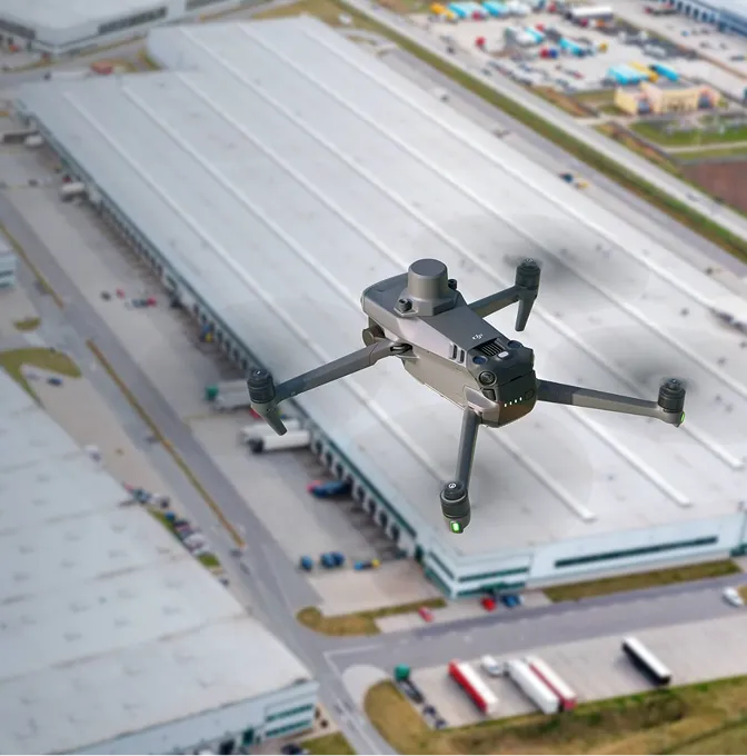
Drone-based roof inspection that replaces ladders and scaffolding with high-resolution aerial imagery — safer, faster and more thorough for residential, commercial and industrial roofs.
Sending someone onto a roof to photograph damage is slow, risky and limited by what they can reach. A drone covers the entire roof surface in minutes, from angles a person on a ladder never gets, with imagery sharp enough to count cracked tiles and measure ponding areas.
We inspect residential, commercial, industrial and institutional roofs. The output is a condition report backed by high-resolution photography — clear enough for insurance claims, maintenance planning, warranty disputes or pre-purchase assessments. No scaffolding, no risk, no gaps in coverage.
A visual record and condition assessment that's clear enough for engineers, insurers and building owners.
Detailed overhead and oblique photographs of the entire roof surface — every ridge, valley, flashing, gutter and penetration documented at resolution that shows individual fixings.
Each defect photographed, located on a roof plan, classified by type and severity, with a recommended action. The format works for your maintenance team, insurer or structural engineer.
A stitched, top-down plan-view image of the entire roof. Useful for area measurement, defect mapping and as a visual baseline for future inspections.
A radiometric thermal layer identifying moisture ingress, insulation failures and heat-loss zones. Available when thermal imaging is added to the scope.
Quick to mobilise, thorough in coverage, and designed to answer a specific question about the roof.
We confirm the building, roof type, the question (insurance claim, maintenance, pre-purchase, warranty) and any access or airspace constraints before arriving on site.
The drone flies a planned pattern over and around the roof — nadir shots for coverage, oblique passes for edges, flashings, gutters and vertical faces. Multiple angles ensure nothing is hidden.
Imagery is reviewed systematically. Defects are identified, classified, photographed in detail and plotted on the roof plan.
The condition report, imagery set and roof orthomosaic are delivered in PDF and digital format. Turnaround is typically 2–3 working days; same-day is available for urgent claims.
Anyone who needs to know the state of a roof without sending someone up there.
Storm damage, hail, fire or water ingress — documented quickly with imagery that meets insurer evidence standards. Faster settlement, fewer disputes.
Scheduled inspections of commercial and industrial roofs to catch problems before they become leaks. Baseline records for tracking deterioration over time.
A clear picture of roof condition before a property transaction completes. Buyers, surveyors and valuers use the report to price risk and negotiate repairs.
As-built roof documentation and snagging inspections. Useful for sign-off, warranty claims and confirming that what was specified was actually installed.
Every roof inspection we deliver replaces a day of scaffolding, manual access and incomplete photography with a 30-minute flight and a report that covers the entire surface.
Answers for property owners, facility managers and insurance professionals.
For surface condition, it's usually better. The drone captures the entire roof at high resolution from multiple angles — including areas a person on a ladder can't reach. You get complete coverage, consistent quality and a permanent visual record. The limitation is that a drone can't lift tiles or test fixings — if that's needed, the drone survey tells you exactly where to send the roofer.
The flight itself is typically 15–30 minutes for a standard residential or commercial roof. Larger industrial roofs may take an hour. Report turnaround is 2–3 working days as standard; same-day is available for urgent insurance claims.
Yes — pitched tile, metal sheet, flat membrane, concrete slab, thatch, composite panels. The capture pattern and flight height are adjusted for the roof geometry and material. Multi-level and complex roof forms are covered with oblique passes that pick up vertical faces, valleys and intersections.
Yes. The imagery and report are designed to meet the evidence standards insurers and loss adjusters expect — date-stamped, geotagged, high-resolution photographs with defects identified, classified and mapped. We've delivered inspection reports that have supported successful storm, hail and water damage claims.
Yes. We fly a radiometric thermal camera alongside the visual camera to detect moisture trapped beneath the roof membrane, insulation gaps and heat-loss zones. This is especially useful for flat commercial roofs where leaks are hard to trace visually.
We operate under a KCAA-approved Remote Operator Certificate (ROC) and hold all necessary approvals for commercial drone flights in Kenya. For most properties, the landowner's consent and our standard risk assessment are sufficient. If the building is near an airport or in controlled airspace, we handle the additional coordination.
Other things our team gets brought in for, often on the same projects.
We hold the regulatory approvals and supplier partnerships required to deliver compliant, audit-ready geospatial outcomes across East Africa.

