High-resolution imagery
Detailed photos from angles a climber wouldn't reach, in sequences that follow the asset.
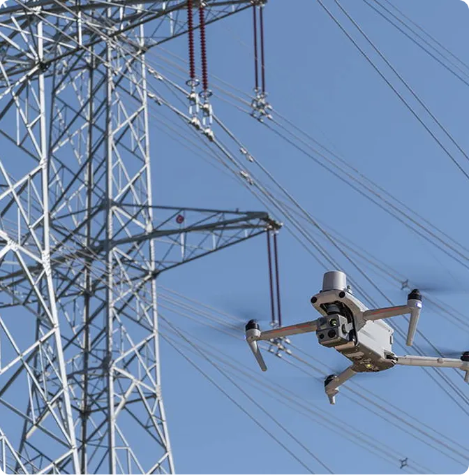
Aerial visual inspection of power, telecoms, pipeline and industrial assets — closer access, less risk.
Sending a person up a 60-metre tower has a cost: time, risk and downtime. Sending a drone has a different cost — and most defects show up clearly in good photography. We capture the asset, the surroundings and the things that worry maintenance teams, while keeping people on the ground.
It works for distribution and transmission lines, telecom towers, rooftops, tank farms, solar plants and most of the difficult-access infrastructure in between. The output is photographs you can act on and a written observation log.
The pack is shaped around how your asset team makes decisions.
Detailed photos from angles a climber wouldn't reach, in sequences that follow the asset.
Stabilised footage for route review, condition documentation and stakeholder briefings.
Annotated notes flagging visible wear, corrosion, damage, encroachment and access concerns.
Capture records organised by asset and date. Easy to revisit when next year's inspection rolls around.
Planned around safety, asset access and the level of detail your team needs to act on.
We map out the assets, access, airspace and inspection objectives before anybody flies.
Pilots set safe paths, viewpoints, stand-off distances and capture settings for each asset type.
Certified operators capture stills and video while keeping safe operations around people, property and live infrastructure.
Imagery and notes packaged so your engineering or maintenance lead can act, not sort.
Useful wherever visibility and access are the limit.
Towers, lines, poles, rooftop equipment — and everything underneath them.
Route condition, encroachment, erosion and surrounding land-use change.
Roofs, tanks, structures, yards and the access points nobody wants to climb.
Thermal and visual inspection of solar panels, inverters and electrical infrastructure — hot spots, damaged cells and underperforming strings identified from the air.
Most of the value is in the photographs. The rest is in the discipline of capturing them consistently, reporting clearly, and making sure the dangerous parts of the work happened from the ground.
Other things our team gets brought in for, often on the same projects.
We hold the regulatory approvals and supplier partnerships required to deliver compliant, audit-ready geospatial outcomes across East Africa.

