Orthomosaics and DSMs
Georeferenced site imagery and digital surface models at the resolution your capture supports. GeoTIFF, ECW or tiled web layers.
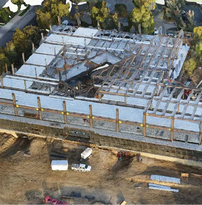
Bureau processing of your drone imagery and LiDAR scans into orthomosaics, point clouds, DTMs, 3D models and CAD-ready outputs — so your team gets analysis-ready data without the software, hardware or learning curve.
Not every team that captures drone data has the software licences, compute power or processing hours to turn it into deliverables. We take raw aerial photographs, multispectral imagery and LiDAR scans — yours or a third party's — and produce the outputs your project actually needs: orthomosaics, DSMs, DTMs, contours, classified point clouds, 3D textured meshes, NDVI maps and CAD/GIS exports.
Ground control points, checkpoints and coordinate systems are handled properly. Every dataset is validated against control before handover, so your engineers, planners and GIS teams can work straight off the products without rework.
Tell us the end-use and we'll shape the delivery. Formats, layers and coordinate systems are agreed before processing starts.
Georeferenced site imagery and digital surface models at the resolution your capture supports. GeoTIFF, ECW or tiled web layers.
Bare-earth terrain models and contour lines at your project interval — ready for Civil 3D, QGIS or whatever your design team runs.
LAS/LAZ files with ground, vegetation, buildings and noise separated. Open in CloudCompare, ReCap, Global Mapper or your own pipeline.
Photoreal site models as OBJ, FBX or GLB for design review, stakeholder presentation or digital twin platforms.
NDVI, NDRE and custom indices from multispectral imagery — calibrated, stitched and exported as GeoTIFF or zoned shapefiles.
DWG, DXF, SHP, GPKG and GeoTIFF with layer names and CRS agreed up front. A short handover note so your recipient knows where everything is.
A clear loop: agree the outputs, receive the data, process, validate, deliver.
We confirm what was captured (sensor, overlap, GSD, control), what you need out of it, and the coordinate system and formats your team works in.
Raw imagery or scans are uploaded or shipped to us. We check completeness, overlap, quality and control before processing starts.
Alignment, dense matching or point-cloud registration, surface generation, classification and product extraction. Independent checkpoints are used to validate accuracy.
Products are packaged in the agreed formats with a short QA note covering RMS values, held-back checkpoints and any quality flags. Delivered via cloud link or hard drive.
Anyone who has raw aerial data and needs it turned into something their project team can act on.
Teams that fly their own drones but don't want to maintain processing software licences, hardware or specialist staff.
Site data captured by a contractor or in-house drone team that needs to be processed into maps, models and reports.
Large-area or multi-site data collection programmes where capture and processing are split across different teams.
University and research teams with drone data that need photogrammetric or LiDAR products to support publications, analysis or fieldwork reports.
Licensed, production-grade tools — not trial versions. Your data goes through the same pipeline we use on our own survey projects.
 Pix4Dmapper
 Pix4Dmatic
 Agisoft Metashape
 DJI Terra
 ArcGIS Pro
 QGIS
QGIS Global Mapper
 AutoCAD Civil 3D
 CloudCompare
 LiDAR360
 Virtual Surveyor
 Autodesk ReCap
Large datasets need serious compute. Our workstations are built for photogrammetry and point-cloud processing at scale.
Dual Intel Xeon E5-2680 v4 (28 cores / 56 threads), 256 GB ECC RAM, NVIDIA RTX 4070, 2 TB NVMe processing drive and 4 TB storage — the heavy lifter for large photogrammetry projects and dense LiDAR point-cloud classification.
Intel Core i9-14900K, 128 GB DDR5 RAM, NVIDIA RTX 4090 24 GB, 4 TB NVMe SSD — handles multi-thousand image photogrammetry projects and parallel processing runs.
Intel Core i7-13700K, 64 GB DDR5 RAM, NVIDIA RTX 4070 Ti 12 GB, 2 TB NVMe SSD — parallel processing of medium datasets while the primary and secondary handle the heavy runs.
Dedicated NAS with RAID redundancy for raw data intake, project archives and client deliverables. Every dataset is backed up before processing begins.
We run Pix4D, Agisoft Metashape, DJI Terra and open-source LiDAR tools daily. The value isn't in the button clicks — it's in the control discipline, the QA and the outputs landing in the formats your team actually works with.
Quick answers for teams considering outsourcing their aerial data processing.
We accept most common drone imagery formats — JPEG, TIFF, DNG — and LiDAR scan files in LAS, LAZ or proprietary formats from major platforms (DJI, Livox, Riegl, Hesai, Velodyne). Multispectral imagery from MicaSense, DJI Mavic 3M and similar sensors is supported. If you're unsure, send us a sample and we'll confirm compatibility.
For survey-grade accuracy, yes — GCPs and independent checkpoints are essential. If your capture was flown with RTK/PPK and you have base station logs, that often provides adequate control. If no ground control exists, we can advise on what's achievable and flag accuracy limitations in the deliverables.
It depends on the dataset size, the products required and the QA cycle. A straightforward orthomosaic and DSM from a 500-image dataset typically takes 2–3 working days. Large LiDAR campaigns or multi-product requests may take a week or more. We confirm turnaround when we scope the job.
Yes — DJI, senseFly, WingtraOne, Autel, custom-built platforms. The processing pipeline cares about image quality, overlap, metadata and control, not the brand on the airframe. We also process data from manned aircraft and satellite imagery where the resolution supports it.
Other things our team gets brought in for, often on the same projects.
We hold the regulatory approvals and supplier partnerships required to deliver compliant, audit-ready geospatial outcomes across East Africa.

