A topographical survey is one of the first professional steps in any land development project — whether you are building a residential estate in Kiambu, a logistics warehouse along Mombasa Road, a solar farm in Kajiado, or a water-supply pipeline in Turkana. It maps the existing ground surface, natural features, and man-made structures on a site, giving engineers and architects the baseline data they need to design safely and efficiently.
Yet many developers and project managers commission topographical surveys without fully understanding what they should receive, what accuracy to expect, or how modern survey methods (drones, GNSS, 3D scanning) compare to traditional approaches. This guide explains the process clearly so you can brief a survey provider confidently and evaluate the data you receive.
What Is a Topographical Survey?
A topographical survey (also called a topo survey or land survey) captures the shape, elevation, and features of a parcel of land. It records natural features (terrain contours, rivers, trees, rock outcrops), man-made features (buildings, roads, fences, walls, utility poles, drains), and ground elevations at a density sufficient to create an accurate digital model of the site surface.
The survey is presented as a detailed plan — typically at scales of 1:500 or 1:1,000 — showing contour lines (lines of equal elevation), spot heights, feature outlines, and annotations. In digital form, the data is delivered as a CAD file (DWG/DXF), a GIS dataset, or a 3D surface model that engineers can import directly into design software.
A topographical survey is distinct from a boundary/cadastral survey (which determines legal property boundaries) and a geotechnical survey (which investigates subsurface soil conditions). However, all three are often commissioned together at the start of a development project.
When Do You Need a Topographical Survey?
Any project that involves significant earthworks, building design, infrastructure layout, or drainage planning needs a topographical survey. Common triggers include: a developer purchasing raw land for residential or commercial subdivision, an architect beginning concept design and needing existing ground levels, a civil engineer designing road alignments, stormwater drainage, or sewer reticulation, a construction company preparing earthworks quantities for tendering, a county government planning an access road or market infrastructure, an energy company siting a solar farm or wind-turbine array, and an environmental consultant establishing a baseline terrain model for an EIA.
In Kenya, the National Construction Authority (NCA) and county planning departments often require a survey plan as part of development application submissions. Engineers and quantity surveyors rely on topographical data to produce accurate designs and material estimates.
Commissioning the topographical survey too late — after design has started — is one of the most common causes of redesign, unexpected earthworks volumes, and construction delays on Kenyan projects. It is always more efficient to survey first and design to the actual terrain.
What Does a Topographical Survey Capture?
A thorough topographical survey for a land development project in Kenya typically captures: ground elevation points at regular intervals (the density depends on terrain complexity — flat sites might use a 5–10 m grid, while undulating sites need 2–5 m spacing), contour lines at 0.25 m, 0.5 m, or 1 m vertical intervals depending on the design requirements, existing buildings and structures (footprints, ridge heights, floor levels), roads, paths, and hard surfaces (including kerb levels and road crowns), boundary features (fences, walls, hedges — noting these are physical features, not legal boundaries), trees (location, species if identifiable, canopy spread, and trunk diameter for trees likely affected by development), drainage features (rivers, streams, ditches, culverts, manholes, invert levels), utilities (overhead power lines, poles, transformers, water meters, telecom cabinets), and spot levels at critical points (road junctions, building corners, drain inverts).
The level of detail captured should be discussed and agreed with your design team before the survey begins. Under-specifying the brief leads to return visits; over-specifying wastes time on features that are not relevant to the design.
Survey Methods: Traditional vs. Modern
Traditional topographical surveys in Kenya use a total station (electronic theodolite + distance meter) and a GNSS rover. A survey crew occupies known control points and measures individual features point by point. This method is precise (1–3 mm per point), flexible, and works well on small to medium sites. However, it is inherently slow on large areas because every point requires physical access by the rod-person.
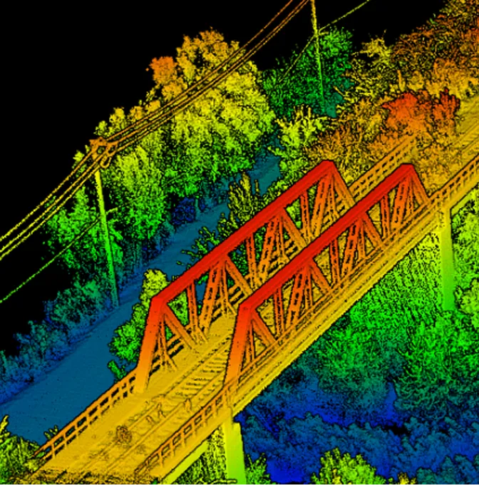
Modern methods introduce drone (UAV) surveys and terrestrial laser scanning. A drone equipped with a survey-grade camera or LiDAR sensor can capture the entire site surface in a fraction of the time, producing a continuous, dense model rather than a sparse point grid. A 50-hectare site that might take a ground crew two to three weeks can be flown in a single day, with processing and deliverable preparation adding a few additional days.
The best results often come from combining methods: a drone captures the broad terrain surface rapidly, while a ground crew picks up specific features (utility covers, invert levels, building floor levels) that the drone cannot resolve with sufficient precision. This hybrid approach is becoming standard practice on large development sites across Kenya.
Accuracy and Datum Considerations
For most land development projects in Kenya, a topographical survey should achieve horizontal accuracy of 2–5 cm and vertical accuracy of 3–5 cm relative to the control network. This is well within the tolerance required for architectural design, road alignment, and earthworks estimation.
All survey data should be referenced to a known coordinate system and datum. In Kenya, the standard projection is UTM (Zone 36S for western Kenya, Zone 37S for the rest of the country) on the WGS84 or Arc 1960 datum, with heights referenced to mean sea level at the Kilindini tide gauge in Mombasa. Your survey provider should clearly state the coordinate system and vertical datum used on all deliverables.
If the site will later require cadastral work (subdivision, title processing), ensure the topographical survey control network is compatible with the Survey of Kenya (SoK) control framework. This avoids having to re-establish control when the boundary surveyor arrives.
Deliverables You Should Expect
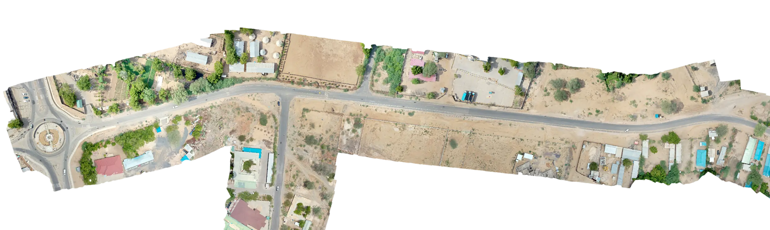
A professional topographical survey report for a Kenyan development project should include: a topographical plan in DWG/DXF format (importable into AutoCAD, Civil 3D, Revit, or similar), showing all surveyed features, contour lines, spot heights, and annotations, a digital terrain model (DTM) or triangulated irregular network (TIN) surface that engineers can use directly for earthworks design and drainage modelling, a survey control report listing all control point coordinates and the methodology used to establish them, an orthomosaic (if a drone survey was conducted) — a high-resolution, georeferenced aerial image of the site, a coordinate schedule — a table of all surveyed point coordinates and descriptions, and a survey report narrative covering the methodology, equipment used, accuracy achieved, datum and projection, and any limitations or exclusions.
If your surveyor delivers only a PDF plan without the underlying digital data, you will struggle to use the survey efficiently in design software. Always specify that you need native CAD files and a digital surface model at the briefing stage.
Common Mistakes When Commissioning a Topo Survey
Vague briefs: Telling a surveyor 'just survey the plot' without specifying the contour interval, features to capture, accuracy requirements, or deliverable formats leads to assumptions that may not match your design team's needs. Write a clear scope of work or ask your surveyor to propose one for your review.
Insufficient control: If your survey is not tied to a robust control network, it may not align with neighbouring surveys, the county cadastral fabric, or future phases of the project. Insist on a documented control network with redundant checks.
Surveying too late: If you commission the topo after design is underway, your architect or engineer may have made assumptions about ground levels that prove incorrect. This leads to redesign, revised quantities, and delays. Survey first.
Ignoring trees and vegetation: On sites with significant tree cover, a standard photogrammetric drone survey will map the canopy surface, not the ground. If you need bare-earth terrain data under vegetation, specify LiDAR or ensure the ground crew captures levels under canopy.
Not coordinating with the boundary surveyor: Topographical and boundary surveys are different disciplines but should share control points. If they use incompatible datums or control networks, reconciling the datasets later is painful.
How Serian Geospatial Delivers Topographical Surveys
At Serian Geospatial we combine drone-based capture with traditional ground survey to deliver topographical data that is both comprehensive and precise. Our standard workflow involves establishing a GNSS control network tied to the Kenya Vertical Datum, flying the site with a survey-grade drone (DJI Matrice 350 RTK with P1 camera or Zenmuse L2 LiDAR depending on vegetation), ground-truthing specific features with a total station or GNSS rover, and processing the combined dataset into contoured plans, DTMs, orthomosaics, and CAD-ready deliverables.
We deliver data in the coordinate system and format your design team requires — whether that is UTM Zone 37S on WGS84, UTM Zone 36S, Arc 1960, or a local site grid. Every project comes with a control report and accuracy statement so your engineers know exactly what they are designing to.